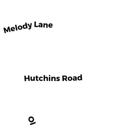
15 HUTCHINS RD
Owner Information
WHITE GEORGE A
1039 ELM ST
FLORENCE, VT 05744


Property Details
15 HUTCHINS RD is classified as a Undevelopable Residential Land.
15 HUTCHINS RD is valued at $52,100. The land is valued at $52,100 and the structures are valued at $0.
The most recent deed for 15 HUTCHINS RD is recorded at the local registrar in Book 27950, Page 156. 15 HUTCHINS RD was last sold on Wednesday, July 30, 2008 for $309,993.
Assessment data from fiscal year 2022.
Flood Data
This property is partially within the AE Zone (within floodplain). Approximately 0.07 acres (60.25%) of the property is within this zone.
The base flood elevation for this flood zone is 13 feet.
This information is sourced from the FEMA National Flood Hazard Layer. See our full disclamer.
Broadband Internet Providers
| Provider | Type | Bandwidth (mbps) | |
|---|---|---|---|
| Comcast | Cable | 1000 | 35 |
| GCI Communication Corp. | Satellite | 0 | 0 |
| VSAT Systems, LLC. | Satellite | 2 | 1 |
| Verizon New England Inc. | DSL | 7 | 0 |
| Viasat Inc | Satellite | 100 | 3 |
| HughesNet | Satellite | 25 | 3 |
Broadband service provider data from December 2020.